Skip to content

Raspberry Pi Weather Station with Satellite Capability

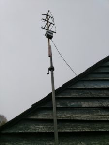
QFH Antenna in place

Home made QFH antenna in place

Having previously built a full blown PC based weather station, I was keen to see if the Raspberry Pi was powerful enough to decode signals from an APT satellite like the American NOAA 15, 18 and 19. A solar powered weather station is the end goal, but the first step was to set up the receiver – from my other projects, I already had the home made QFH Antenna and a USB SDR.

Then I found this great article on instructables which describes, step by step, how to set up the Raspberry Pi with the right software (predict, wxtoimg, sox and a few other packages).

Once the Pi was all set up, including the scripts and cron table update to automatically enable the receiver when a satellite was passing overhead, I needed to link the pi to the QFH antenna and SDR dongle.

The trick to getting a decent result is to maximise the Signal to Noise ratio – by keeping the cables carrying signal short and by minimising the noise received by the SDR dongle. In the image above, the SDR dongle is inside the plastic box, processing the signal as close to the antenna as possible. A USB extension cable is then seen coming out of the box – this is then connected to the base station.

Connecting the QFH Antenna to the Raspberry Pi

Using the USB connection is easy enough but the Pi needed an internet connection to update the satellite pass predictions, so it knows when the satellites are passing overhead.

Raspberry Pi Weather Station

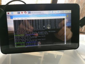
Raspberry Pi w/touchscreen connected to USB SDR and WiFi

Getting a WiFi link to work all the way to the Pi was tricky, but I have an extender established so once I managed to get the Pi a line of sight to the house, we were good to go!

Some of the results from the last few days are below, there are about two passes per day that have a Maximum Elevation Level (MEL) greater than 20 degrees so there is a wide variety of quality.

Overall the Raspberry Pi performs extremely well in this role, better than the rather weedy Intel i3 powered PC that was previously set up. Next step is to add the Sense Hat and possibly air quality sensors to the rig – and get on the Weather Underground.


Raspberry Pi Weather Station with Satellite Capability – Results

A few images using a basic false colour rendering for land/sea, showing the cloud cover over the UK and Europe.
NOAA 19 – 6th April 2018

NOAA 19 – 7th April 2018

NOAA 19 – 7th April 2018


Steam user number blip

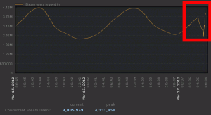
After logging into Steam today I noticed this weird drop in online users – something caused by a server upgrade?  The service seems to be functioning well as the time of writing. The number of currently online users curve has returned to trend in the graphic below.

Steam online user blip in the last few hours

Steam online user blip in the last few hours

After a drop of around 1M users the number quickly returned to trend

After a drop of around 1M users the number quickly returned to trend

TSCC – Can’t play video AVI?

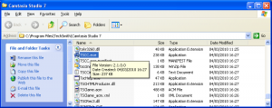
TSCC Codec Installer in Camtasia directory

TSCC Codec Installer in Camtasia directory

By default, video AVI files created by Camtasia Studio use the TechSmith Screen Capture Codec (TSCC).  If you can’t play them from your favourite media player you can either locate, download and install the TSCC codec (which is free to distribute) or use the CamTasia free player.

OpenCaching

OpenCaching

OpenCaching

Just saw this pop up on the radar, and it seems like a neat idea.  Personally I never got into the GeoCaching thing too much before (you had to buy the App), but this supposedly has an open platform so it’s probably worth another look.  A quick check of the South coast reveals a cluster of caches near Southampton, someone from “the survey” perhaps?  The capability to send to GPS or download GPX files is very welcome, I’ll post an update when I have had a go with the devices…

One (UK address) gazetteer to rule them all

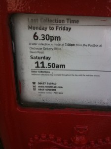
Post Box

Deliveries to large numbers of flats within a single post code have been a problem

Spotted this on The Register and announced yesterday, GeoPlace has been formed through a joint venture partnership between the Ordnance Survey and the Local Government Group. This is a big step forward towards bringing together the confusing mix of licences, products and data sets available from which public and private sectors have to figure out addressing.
In almost every place I have lived, there has been a poor record in the Royal Mail database, mixed up flats, wrong numbers and delivery errors – I sincerely hope and believe that this step forward will help sort out this mess.

Maritime Chart spotted in the wild

Spotted a set of old maritime charts being used to cover some manequins, nice recycling but would have been better on a wall. Always fun to try and work out where they relate to, definitely not the uk.